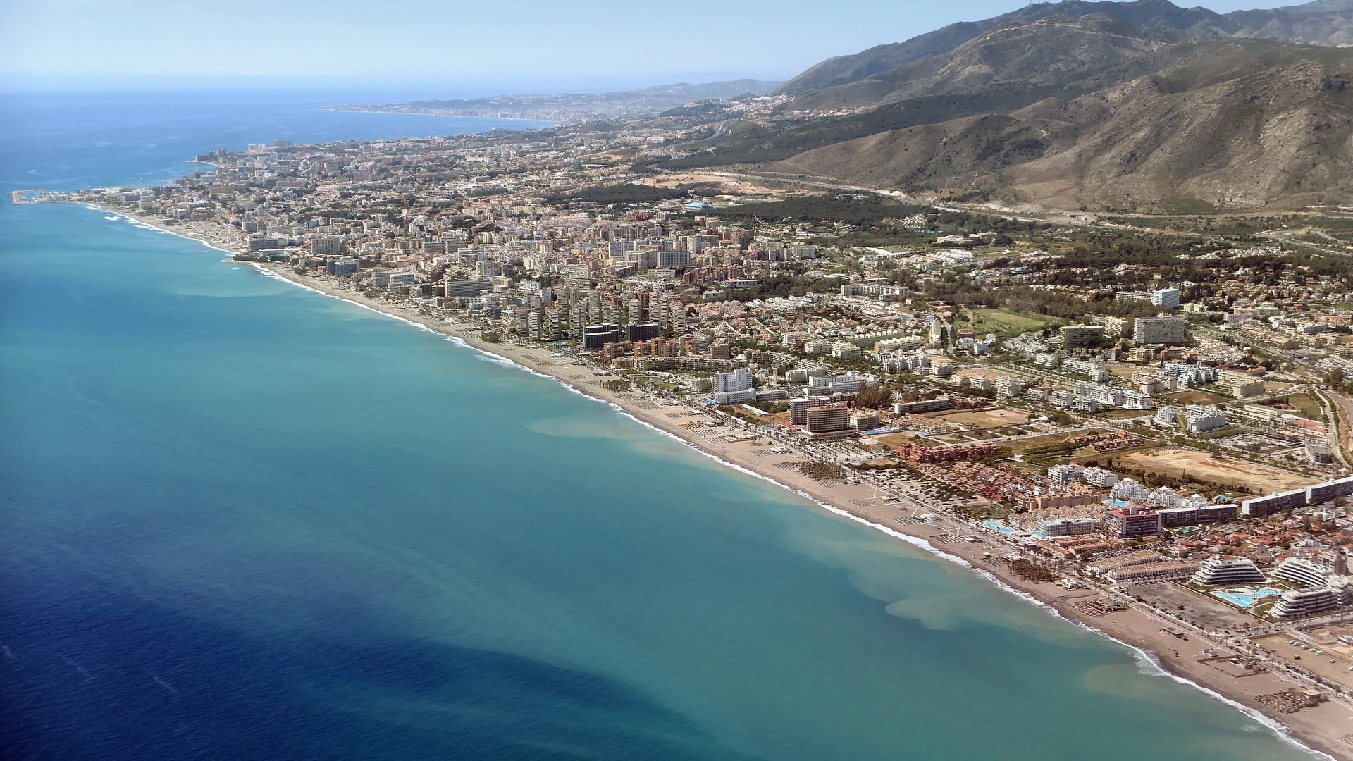
Yes, Torremolinos has an old centre, best seen on foot from the top of town to the sea: down Calle San Miguel to the Pimentel Tower, a Nasrid tower built around 1300 that gave the town its name, then the Cuesta del Tajo stairs to El Bajondillo beach. From there the promenade takes you past El Morro to La Carihuela. The place facts come from Turismo Torremolinos.
Does Torremolinos have an old town?
Yes – its oldest landmark is the Pimentel Tower, a Nasrid defensive tower built around 1300 that gave Torremolinos its name, according to Turismo Torremolinos, and it stands between Calle San Miguel and the Cuesta del Tajo, on the way down to El Bajondillo beach. That short run from Calle San Miguel through the tower to the sea is the old centre this walk follows.
Turismo Torremolinos doesn't draw an "old town" boundary in the pages we read, so we use the term for the streets around Calle San Miguel and the tower rather than for a mapped district.
Down in El Bajondillo, Casa de los Navajas was built in 1925 in Neo-Mudéjar style with Mozarabic touches, on a family fortune from the sugar cane of the Guadalhorce estuary, the tourist board says. It hosts weddings, exhibitions, concerts and theatre, and entry is free when it is open, so check whether it is open as you pass.
What is the best walk from the top of Torremolinos to the beach?
The walk runs from Calle San Miguel down to the sea and then west along the promenade, in eight stops:
| Stop | What it is | Source |
|---|---|---|
| 1. Calle San Miguel | The street that leads down to the tower | Turismo Torremolinos |
| 2. Pimentel Tower | Nasrid tower, around 1300, 12 m high | Turismo Torremolinos |
| 3. Cuesta del Tajo | The stairs from Calle San Miguel to the promenade | La Tierra's own site |
| 4. Casa de los Navajas | Neo-Mudéjar house built in 1925 | Turismo Torremolinos |
| 5. El Bajondillo beach | The town-centre beach, ~1.3 km long | Turismo Torremolinos, beach charter |
| 6. Paseo Marítimo | Promenade with a bike lane, open all year | Turismo Torremolinos |
| 7. El Morro | Natural monument and viewpoint halfway along the town | Turismo Torremolinos |
| 8. La Carihuela | The old fishing quarter, ~2.3 km of beach | Turismo Torremolinos, beach charter |
We haven't measured the route, so we give no total distance or time. For scale, the municipal beach charter puts El Bajondillo at ~1.3 km and La Carihuela at ~2.3 km long. On the Cuesta del Tajo, La Tierra sits on the stairs – see where to eat in Torremolinos for it and the rest of the town.
For longer walks, Turismo Torremolinos names other routes, including the Senda Litoral coastal path, the Camino del Agua and the Gran Senda de Málaga; we haven't walked or measured them. We haven't verified a guided free walking tour in Torremolinos either, so this route is self-guided.
What is the Pimentel Tower?
The Pimentel Tower, or Torre de los Molinos, is a Nasrid defensive tower built around 1300, in the 14th century, and it gave Torremolinos its name, according to Turismo Torremolinos. It is built of rammed earth, stands 12 m high and has two floors and a terrace.
It is a Monument of Cultural Interest (BIC), at Cuesta del Tajo 8, between Calle San Miguel and the Cuesta del Tajo. It later took the name of Pimentel, a soldier who helped Ferdinand and Isabella take Málaga, the tourist board adds. Access to the interior varies, so check with the tourist office.
What is El Morro?
El Morro, or Punta de Torremolinos, is a natural monument and promenade viewpoint at "the halfway point of the town", the natural boundary between La Carihuela and El Bajondillo, according to Turismo Torremolinos.
On its travertine ledge stood an 18th-century gun battery, which British soldier George Langworthy later converted into "one of the first hotels on the Costa del Sol, Hotel Santa Clara", the tourist board says. The tourist board also notes an early topless photograph of Gala Dalí among the stories of the place.
Where does the promenade run?
The Paseo Marítimo runs from Saltillo beach at the La Carihuela end to Los Álamos beach, "the most easterly point of Torremolinos", and El Morro divides it into two stretches, according to Turismo Torremolinos.
It has a bike lane, is accessible and is open all year, the tourist board says. It runs behind all four municipal beaches, which add up to ~6.2 km of sand in the municipal beach charter; we haven't measured the promenade itself. For which beach to stop at, see the best beaches in Torremolinos.
Is Parque de la Batería worth a detour?
Yes, in our judgement, for a view or with children: Parque de la Batería covers more than 74,000 m², with more than 1,000 trees of 25 species and a 15 m observation tower with a panoramic lift, according to Turismo Torremolinos. It sits north of La Carihuela, next to Montemar-Alto station.
Entry is free, and the park has a Venetian-style carousel, a large children's play area, old cannons and two underground bunkers, plus more than 150 parking spaces; pets are allowed. Our guide to Torremolinos with children covers it alongside the town's other family stops.
Start at Calle San Miguel, take the Cuesta del Tajo stairs past the Pimentel Tower to the sea, and walk west past El Morro to La Carihuela.
To reach the start by train, see our practical tips for Torremolinos; for the rest of the town, see things to do in Torremolinos.
FAQ – Walking in Torremolinos
Images: Adam Cli / Wikimedia Commons / CC BY-SA 4.0
Reader Comments 💬
Share your experience or ask a question